Scott Olson / Getty Images News
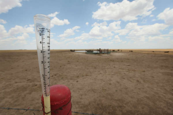
Usually when Texas beats Oklahoma it’s something for the Lone Star state to celebrate, like when the Longhorns defeat the Sooners in college football’s storied Red River Rivalry. But not every record is worth holding. This year Texas set a new national record for the hottest months of June through August, besting a record formerly held by Oklahoma during the Dust Bowl of 1934. The average 24-hour statewide temperature during the summer was 86.8 F—more than a degree hotter than Oklahoma’s 1934 summer of 85.2 F.
Texas state climatologist John Nielsen-Gammon tried to explained just how widespread and relentless Texas’ heat has been:
It has been scary hot from one end of Texas to the other. The dryer it is, the hotter the ground gets during the summer, and it becomes a cycle that feeds on itself. It gets dryer, and it gets hotter.
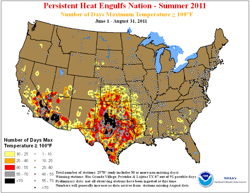
But Texas—which has also experienced the driest 12 months in the state’s history—is far from the only corner of the U.S. to swelter this summer. This week the National Oceanic and Atmospheric Administration (NOAA) announced that nationally the summer was the second warmest on record, with an average summertime temperature of 74.5 F, which is just a smidgen below the record summer of 1936. Four states—Texas, Oklahoma, New Mexico and Louisiana—all set records for summertime heat. (That’s right—if Texas hadn’t broken Oklahoma’s 77-year-old record, Oklahoma would have busted the figure itself.) And while the worst of the heat was experienced by the Southwest, including Texas—as the NOAA map below shows—not a single state in the lower 48 experienced temperatures below the August average.
More from TIME: The Great Dry State of Texas
Some other amazing climate facts from the summer that sizzled:
- Thanks in part to the deluges of Hurricane Irene, New Jersey, New York, Vermont and New Hampshire had their wettest August on record. (New York City alone had 18.95 in. of rain in August, more than two in. greater than the previous record, set back in 1882.)
- Even as the Northeast was drenched, however, drought covered one-third of the continental U.S., and parts of Louisiana, Texas, New Mexico and Oklahoma experienced droughts of greater intensity than the catastrophic dry spells of the 1930s and 1950s.As a result, hurricane or no, nationwide precipitation in August was 0.29 in. below the average.
- All that heat meant air-conditioning use. Energy demand in the continental U.S. was 22.3% above average this summer, the largest amount of power on record.
More from TIME: Parched Earth
Temperatures will call as we turn into autumn, but the South in particular won’t get much relief. That’s because the La Nina weather pattern has reemerged and is forecast to strengthen through this winter. NOAA’s Mike Halpert explains what that means:
This means drought is likely to continue in the drought-stricken states of Texas, Oklahoma and New Mexico. La Niña also often brings colder winters to the Pacific Northwest and the northern Plains, and warmer temperatures to the southern states.
So any hope that Texas and the Southwest will be saved by a rainy fall seem dashed, and this epic drought—which has already cost billions and helped fuel devastating wildfires—will only continue. The high in Austin today is expected to be 96 F. It won’t get much better.
More from Ecocentric: Welcome to the Era of the Billion-Dollar Disaster
Of course, the summer of 2011 really was unusually hot, and may stand as an outlier for a while. (The Houston Chronicle‘s Eric Berger has a neat post on how the unusually hot weather this August in Houston was, statistically, a 1-in-10,000 year event.) Bu we’re headed towards a climate where summers like the one we’re experiencing in 2011 will be the norm, not the exception. The U.S. is a huge country, with tremendous climatic diversity—which is why such an unusually hot summer only produced an average temperature of 74.5 F. That might sound perfectly balmy to most of us. Similarly, scientists often warn that we need to keep average global temperatures from rising above about 3.6 F—which, of course, sounds like nothing. (In New York City, temperatures will have moved more than 15 F over the course of today.) But hidden within that bland worldwide average will be temperature spikes that will make the Texan summer of 2011 seem like an air-conditioned movie theater.
Forecast: unpleasant, unhealthy and unbearable.
More from Ecocentric: Hurricane Irene Bears Down on the U.S.
Bryan Walsh is a senior writer at TIME. Find him on Twitter at @bryanrwalsh. You can also continue the discussion on TIME’s Facebook page and on Twitter at @TIME


