


A satellite image shows the full breadth of Typhoon Haiyan
It’s been an unusually quiet season for hurricanes over in the Atlantic this year, with relatively few storms forming and even fewer making landfall in the U.S. But the western Pacific Ocean—where tropical storms are called typhoons—hasn’t been anywhere near as lucky. (Hurricanes, typhoons and cyclones are all tropical storms—the only difference is where they happen on the globe.) There have already been three Category 5 typhoons so far, the most powerful, reserved for storms with sustained winds of over 157 mph (253 k/h). How unusual is that? The Atlantic hasn’t had a Category 5 storm since Hurricane Felix in 1997, and hasn’t had a major hurricane—Category 3 or above—make landfall since 2005, the longest span on record.
Now the western Pacific is about to get hit with another Category 5 typhoon—and it looks poised to break records. Super Typhoon Haiyan is poised to bulldoze the central Philipines with maximum wind speeds that appear to be among the strongest in history. As of Thursday afternoon, Haiyan—which goes by the name of Yolanda in the Phillipines—had estimated maximum sustained winds of 195 mph (314 k/h), with gusts over 220 mph (354 k/h). Only a few other storms have ever had winds close to as strong as Haiyan, and no hurricane in the Atlantic measures up. It’s the definition of a super storm.
You can see just how massive Haiyan is in this gif from the National Oceanic and Atmospheric Administration (NOAA), taken earlier on Thursday:

As NOAA noted in a post, the conditions are perfect to fuel Haiyan’s fury:
The intensification of Super Typhoon Haiyan is being fueled by “ideal” environmental conditions – namely low wind shear and warm ocean temperatures. Maximum sustained winds are currently at 195 mph, well above the Category 5 classification used for Atlantic and East Pacific hurricanes.
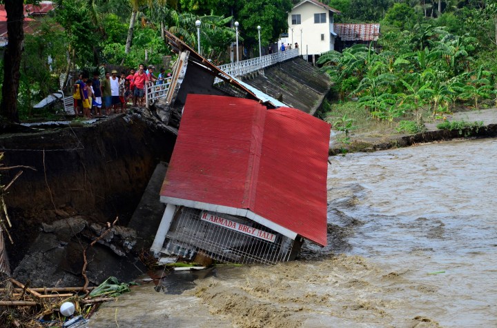
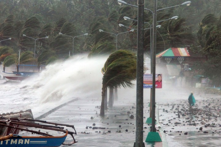
Though the storm will weaken slightly, it’s still likely to be incredibly strong when it makes landfall in the Philippines Friday night local time, where it threatens the city of Tacloban in Leyte province with massive storm surges and mudslides. While the capital city of Manila will likely be spared a direct hit, it will still experience enough flooding to cause danger, especially in low-lying areas. From then on, forecasters expect the storm to continue tracking toward the Southeast Asian mainland, approaching Vietnam by the end of the weekend.
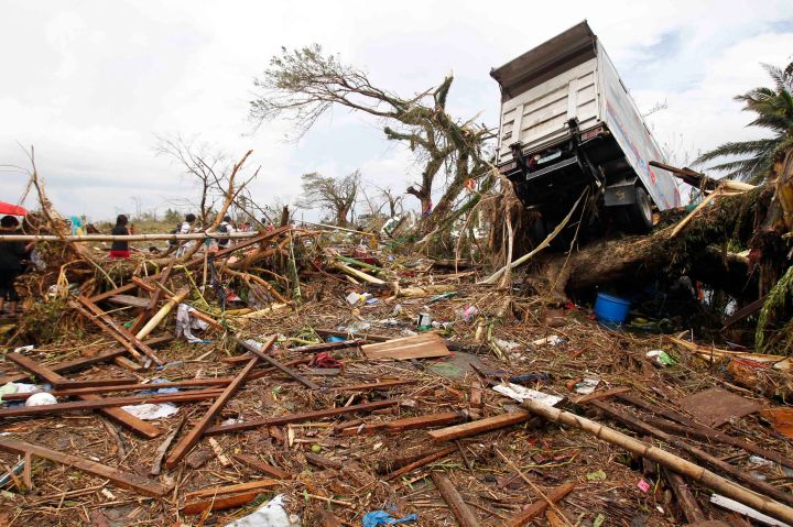
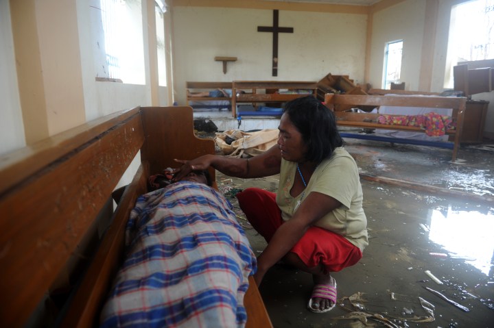
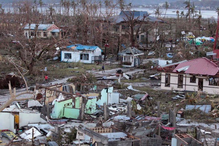
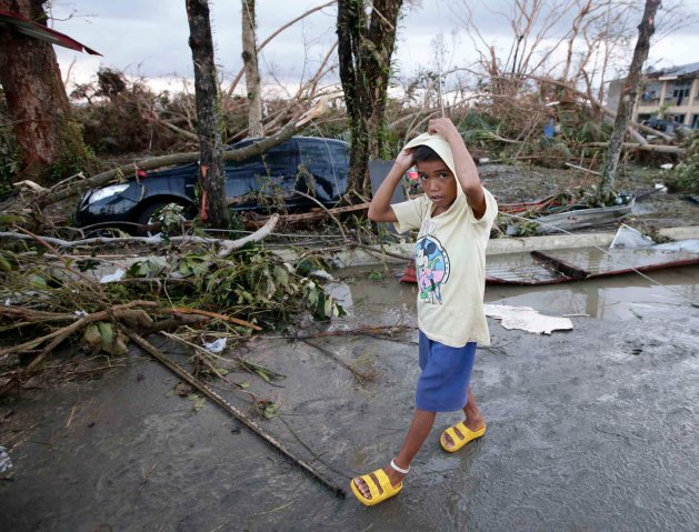
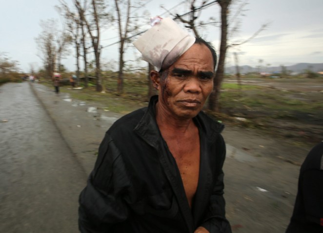
Even if Haiyan somehow falls short of being a record-breaker, the death toll from the storm as it rakes across a relatively impoverished country like the Philippines will almost certainly be high. A 2006 mudslide in the country’s Leyte province killed over 1,000 people—a disaster that had less to do with the rains than with years of poorly regulated mining and logging. Death tolls from natural disasters are as much a matter of poverty and preparation as they are of wind speed and rainfall. The Philippines—and the other countries in the path of this epic storm—will need help.
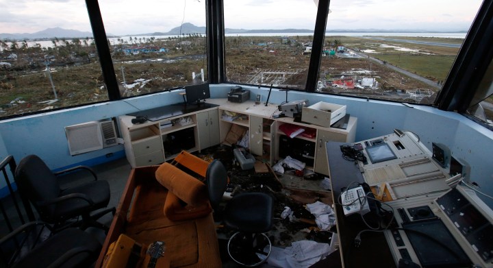
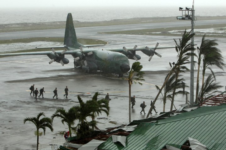
Typhoon Haiyan Cuts a Path of Destruction Across The Philippines

(MORE: As Tropical Storm Karen Dissipates, the Debate Grows Over a Quiet Hurricane Season